
Kibera Community Map
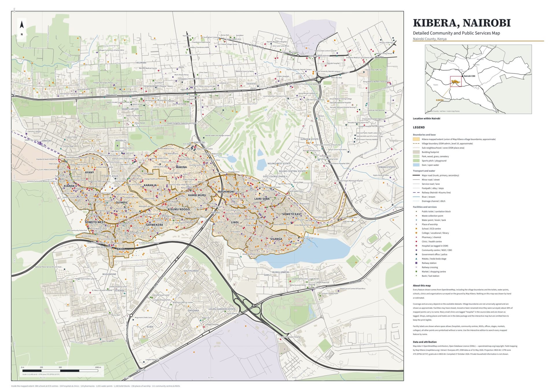
A detailed community and public services map of Kibera, Nairobi. It shows village boundaries, roads, footpaths, the railway, rivers and drainage, and the public facilities mapped on the ground by Map Kibera and the OpenStreetMap community: schools, clinics and hospitals, pharmacies, water points, toilet blocks, places of worship, community centres and NGOs, police posts, markets and matatu stages.
Explore the interactive map
Search for a school, clinic, village or road, switch layers on and off, and zoom in to see individual buildings. Open the map full screen.
Downloads
- Printable A2 map (PDF, 4.6 MB) – scale 1:12,400, ready for print.
- GIS data package (ZIP, 5.6 MB) – GeoJSON layers (villages, roads, buildings, facilities, water, railway), a QGIS project file and the Overpass queries used to build the map.
What is inside the mapped area
380 schools and ECD centres, 154 hospitals and clinics, 124 pharmacies, 1,031 water points, 1,168 toilet blocks, 236 places of worship and 111 community centres and NGOs.
About the data
Every feature comes from OpenStreetMap, including field mapping by Map Kibera. Village boundaries are not universally agreed and are shown as approximate. Facilities may have closed, moved or been renamed since they were surveyed. Map data © OpenStreetMap contributors, Open Database Licence (ODbL). OSM data as of 31 May 2026; compiled 27 October 2026. Private household information is not shown.

Kibra Youth Network
We are a youth-led movement in Kibera creating safe spaces for mental health and helping every child stay in school.
Contact UsRelated Posts

Five Ways to Support KYN Beyond Donating
05 Sep 2026